


Factsheet 4×1
Date: 24/08/2012 the 28/08/2012
Saímos of: Los Angeles, CA – USA
Stop em: Santa Bárbara, CA – USA
Final destiny: Monterey Peninsula, CA - USA
Total distance: little more than 560 km (in 4 days)
Travel time: The Angeles - Santa Barbara (2 ½ hours) Santa Barbara - Monterey (10 hours - counting COUNTLESS breaks for photos and dinner)
* Path: Saímos of Los Angeles and stick to Highway logo 1 Até Santa Bárbara. From Monterey Peninsula Fomos for (where is located Monterey and Carmel) through the most beautiful part of the road: o ‘Big Sur’!
Where to sleep: Santa Barbara and Monterey - as we had no Tanajura - shared a motel room.
What we eat good: Cooked vegetables, a delicious thin-crust pizza and dessert in the cozy restaurant Big Sur Bakery & Restaurant, em Big Sur.
Filled Tire : Despite the breathtaking views of the Highway 1, trails at Point Lobos State Natural Reserve is simply a must for anyone who travels this stretch of California.
Tire murcho: The high prices of motels in the area - it is good to book in advance, even in late summer.
Be watching a Hollywood release, ouvindo o ‘surf rock’ do The Beach Boys ou o estilo ‘alternativo’ do Red Hot Chili Peppers, California has always been - somehow this throughout our lives. O ‘Golden State’, As is known state, houses the famous cities of Los Angeles and San Francisco; is also one of the main granaries of the technology industry (Vale do silicon) and today one of the largest producers of wine. Several roads cutting state, mainly from North to South, but what stands out most is called Highway 1 born in Dana Point (ao sul Los Angeles) and extends to San Francisco.
And there was the Expedition 4×1 again about to face a few more hours long road. But this time there would be a road like any other. Era ‘A’ Highway 1! For those who remember the song 'The road curves Santos' Roberto Carlos, it knows that the king imortalizava one of our most famous and beautiful Brazilian roads: Rio-Santos (BR-101) cutting beaches as Ilhabela, Ubatuba, Paraty and Angra dos Reis. So too with the legendary Highway 1 connecting Los Angeles, Malibu, Santa Bárbara, Carmel and Monterey Peninsula na, finally, San Francisco!

Despite the most beautiful stretch (and more swirled) San Luis Obispo between being and the Monterey Peninsula - where is the area known as Big Sur - Expedition opted to walk the Highway 1 entire, from Los Angeles.
We left Los Angeles after lunch, paying the beaches of Santa Monica and Malibu, After a photo or other, come to Santa Barbara around 16h. The first thing we did was look for a Starbucks to use the internet to find we provide a cheap motel - because we had seen so far were too expensive. We were still in the company of Daniel and Lu and in the spirit of enjoying the city we walked down the main street to the Santa Barbara Pier.

One thing that caught our attention on the Pier was the creativity of some alms to beggars who created some "games" cardboard (style shoot-to-target) so you used his money to hit the target! American really knows earn money!

Trendy and very tidy, Santa Barbara is known as the American Riviera, and is seated at the foot of the steep Santa Ynez mountain. In the late afternoon, witnessed a fine mist that moved over the coconut to be barred by the Santa Ynez! Um Belíssimo visual!

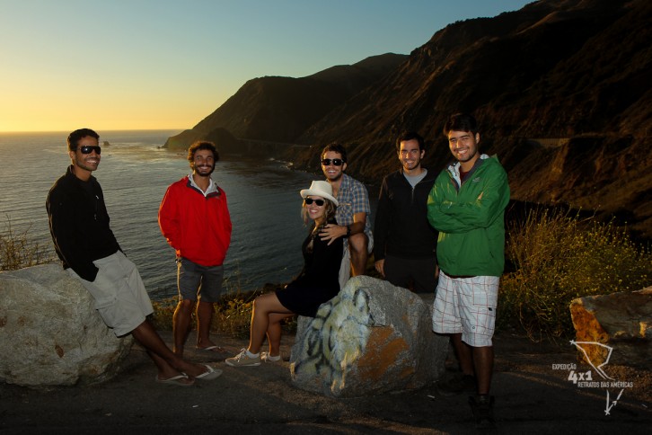
It was a Friday, walk a little more and the night ended in lively bar for Sharkeez celebrate 24 years of Gustavo, when crossing midnight!!! Yes… Our photographer friend, filmmaker and cook the expedition was more "old man"! The second birthday during Expedition! ![]()

The next day we divided into two parts:
1) In the morning we head to the Route of wines of Santa Barbara. Although much smaller than the famous Napa Valley, we went in search of meeting her hoping to find some small winery, that was less glorious than those of Napa. We follow without much research westbound on CA-154, enjoying the beautiful view of the dry passing next to Lake Cachuma to fall, unconsciously, in front of a traditional winery called Bridlewood, built along the lines of the Spanish missions that dominated the west coast Californian. While not as small as expected was a gorgeous winery! Perfect for a picinic! Too bad we had not brought anything.

2) We returned to Santa Barbara in the late afternoon to take a last walk around town and know the historical center. Unfortunately, as I passed the 17h, many things were closed. We could only appreciate from the outside and learn more about the city's history with the help of Ralf (nickname we gave to our guide book about the U.S.) =D

No give 26 agreed anxious, it would go through the best stretch of Highway 1. We started from Santa Barbara to Monterey Peninsula rumo! After a typical super-reinforced and breakfast in the restaurant Joe’s, Daniel left the station to catch the train back to LA, around 12pm. Unfortunately he could no longer follow with us. But we would still have the company of Lu for a few more days!
This first stretch of Highway 1 is less interesting and many people make the US-101 to San Luis Obispo where again take the Highway 1. However wanted to go to Highway 1 and that the entire road stretch passes through some very small towns and farms with rural aspects, which was interesting to see. But arriving in San Luis Obispo things change! From this excerpt begins the best part of the trip, where the road almost touching the beach and watching the mountains go way. We put some music to play on Beetle (nickname we gave to temporary Tanajura cousin who led us on this path) ![]() cameras and prepared to seize every bend in the road.
cameras and prepared to seize every bend in the road.

The blue ocean contrasts with the white of the strong waves that crash against the walls of the cliffs or sometimes with some red algae that grow to the surface in some parts of the California coast.

But the highlight of the trip is the region known as Big Sur! The Big Sur is not a city, but only a region just before the Monterey Peninsula where the Santa Lucia Mountains rise abruptly and steeply along the coast. This forms a chain of hills and mountains to the sea, counting with a peak of 1.571m, unless 5 miles from coast! The Big Sur is also designated by the U.S. government as a 'National Scenic Byway’ (quality given to those areas where the road has at least one characteristic, dentre as 6 following: archaeological, cultural, historical, natural, recreational, and / ou visual) In this stretch is where the image is 'postcard' Highway 1 that is where it appears the Bixby Creek Bridge. We were there for over half an hour taking pictures and waiting for the sunset, sun, worth every minute!!! (besides the picture below the photo at the top of this report was also taken there!)

As it was late we had lunch over there. The temperature also dropped significantly. After one region is highest and well bush so the temperature contrasts well with the beach below (even though being very close to it). Our dinner was very cozy in the Big Sur Bakery & Restaurant that has a very diverse menu with soups, cooked vegetables (dishes cooked with various vegetables - very interesting), excellent pizzas (especially when compared to American standards which are mostly heavy and massudas), delicious desserts and a good wine list. As we were still in the mood of the anniversary of Gustav, decided to open the wallet a bit and enjoy a meal more "complete" ![]()

We arrived late in Monterey and the next morning we enjoy it. The city lies on the peninsula bearing the same name, and which is also located in the famous city of Carmel. Monterey was an important colony of Spanish America and became famous from fishing, The main economic activity, and the consequent emergence of sardine canneries. Due to overfishing (problem begins to increase in many regions of the world and in some parts of Brazil), in the decade of 50, many of these companies came bankrupt and the city went into decline. In recent times, entrepreneurs invested in the city rebuild, that turned into a tourist hub and currently has a large aquarium (due to our budget constraints we chose not to visit) and, amid bankrupt factories canning sardines, restaurants and hotels were built - these, located along the tourist street Cannery Row.

After the return to the center to follow the 17-mile drive a small private road, with beautiful views that line the beaches of the Monterey Peninsula and where mansions are seen along the famous Pebble Beach golf course.

The exotic cypress trees (cypress trees) spread along the coast making a beautiful view to the sea. There is the option to go to the Monterey 17-mile drive bicycle, but for that you need a full day of cycling (which would be difficult for us since we had time to get to Seattle and still wanted to know other things along the way).

Continue to fleece the city of Carmel whose official name is Carmel-by-the-sea and is just minutes from Monterey. Carmel is a tourist town that had its peak of fame when, curiously, between 1986 and 1988 had as mayor actor Clint Eastwood!! That even the "tough" action movies! Before knowing its center, we get to know the historic Carmel Mission which is very well preserved and dating an interesting chapter of the passage by California Spanish. With a basilica, convent, cemetery, a beautiful garden, besides other rooms, the mission has several artifacts that allow quite know the history of the passage and the period of Spanish colonization of the State.


It is curious to notice that while on the west coast, America still lived a period of consolidation of colonies, Christianization of Native and, later, the territorial dispute against Mexicans; across, but nimble, already beginning the first glimmerings of independence and movements that would form the American republic. More curious still is thinking that, still yes, in just a few decades following, both coasts possess equally prosperous and developed cities like Los Angeles and San Francisco (West side do) and Nova York, Boston and Chicago (side do Leste).
We left there and finished the afternoon with a tour of the sophisticated and very pleasant downtown Carmel with its many art galleries, bookstores and antique shops all within a small and cozy shops where you feel like you're entering a family home.
And to crown our passage through Highway 1 spent the last day in the Natural State Reserve Point Lobos near Carmel there. With numerous trails, average, 1 the 2 km, You can know the entire booking within a day or even an afternoon. And we did. We arrived late in the morning and walked to the middle of the afternoon.

The trails lining the beaches of the reserve that have gorgeous views of pristine at its edges and darker (due to the depth) a few meters from the coast. Rocks, cypress trees (cypress trees) and pine complement the landscape.

But otters are sympathetic, sea lions and seals that call more attention on sidewalk, as can be seen in abundance in some parts of the reserve. Inclusive, Point Lobos was the name given by Spanish navigators who heard the sounds of Sea Lions (as they called sea lions) when passing through the region. Even with the water very cold and we could not resist taking a dip!

Incredible to think that Point Lobos was not in our initial script, because we had never talk about the park - which even has free admission! But, actually, was the icing on the cake in our passage by the legendary Highway 1. And these are all ingredients of history, culture, natural beauty and heterogeneous economic training that make this route so special!

Ahhhh…and if you want to know more about the sea lions there in Point Lobos is simple: just look one of the nice ladies and gentlemen who volunteer to work in the park talking with tourists and telling them a little about the history of the region and those friendly locals. Incredible, not?!!

To check out more photos of this stretch of the Expedition 4×1, click here ![]()
8 Comments
Boys…really this region is WONDERFUL ! A vista que vi na Highway 1 avowed… be one of the most beautiful I have ever seen. I did the opposite of you; from San Francisco to Los Angeles . Ah… I miss you!
Good Luck!!! Always!
Or Giselle!! Really, o visual da Highway 1 it's impressive!! That road cutting the mountains and being almost lapped by the sea does not come out of our memories!!! Hugs from all of us!
very good parabens is to travel
Emanuel Valeu! I hope you enjoy the Expedition
Lu is longing for you!!!!
ahhhhhhhhhh I wanted there to be the alaska passing cold cocêis!!!
Ae Luuuu!!!
We are also miss!!! Meets with new people in Central or South America!!
There are people here who would be especially happy! hahahaha
WHAT A PRIVILEGE!!!
REALLY IS A REGION LINDA. THEATRE FIRST AMERICAN IS THERE TB, IF DO NOT MISTAKE IN MONTEREY OR THE BANDS, WELL pequeninho AND DID APRESENTAÇÃOES character- OF SEASON, THAT AT THE END OF THE YEAR 70.
Our did not know that!! That legal!!
We have seen in fact an outdoor theater in Carmel. Very simple. But we do not know if this is what you're mentioning.
Ation are worth peel!